From roads and bridges to mines and skyscrapers, every structure that we see today was built on an empty plot of land. This is what makes humankind entirely different from other species. Just as our wants and needs grow, so too our knack for creation evolves. Such a skill allows us to create something out of nothing and to make the most out of what we have, just to satisfy our demands and preferences. Whether they’re for shelter or for transport systems, structures involve the skillful hands and knowledgeable minds of construction professionals.
Most people understand that behind the construction of buildings are architects, engineers, and contractors who painstakingly plan and oversee projects. However, it’s probably a lesser-known fact that preparing the area for construction also requires a specific profession. A flat plot of land for construction does not merely come out of the blue. On the contrary, it is measured and perfected through the art of surveying.
Ever since the dawn of civilization, people from all over the world have already been utilizing surveying techniques. Surveying, in a nutshell, is the profession and science of finding out the three-dimensional positions of points and measuring their distances and angles. This technique allows land surveyors to establish boundaries for ownership, delineate land maps, and determine subsurface features and locations for properties.
Surveying basically involves observing and inspecting the land, gathering information, measuring the area, analyzing the data, devising questionnaires, and other tasks for research. These tasks can be a little daunting for some, but there’s no denying that this profession can get interesting or even exciting. Being a land surveyor is indeed a noble job. It’s perfect for people who cannot imagine sitting still every day and who love to take on challenges and to learn new things from every task. If you’re interested in becoming a land surveyor, then read on to learn how to be a successful and licensed one.
Understanding the Role of a Land Surveyor
Before starting any new career path, it is, of course, imperative to know what you’re getting into. Surveyors are not just those who set up their tripods and rods at the side of the road. Some of them might serve as legal mediators for determining boundaries of properties. Others might consider themselves surveyors slash explorers, like Captain Meriwether Lewis and Lieutenant William Clark. Lewis and Clark took on an expedition to the unchartered areas of North America, mapped newly acquired territories, and established America’s claim to the West. Apart from these two explorers, three out of the four U.S. Presidents on Mount Rushmore—Thomas Jefferson, Abraham Lincoln, and George Washington—were also land surveyors who surveyed frontier territories. Regardless of the varying roles that land surveyors take, what they all have in common is their responsibility to measure with the utmost precision.

From the major cities in the world down to the icy wonderland of the South Pole, every part of the world can be a job site for surveyors. Land surveyors know about a wide assortment of fields of studies, such as geometry, physics, engineering, programming languages, and even the law. Depending on the task at hand, they can work in the field, office, or even both. However, most surveyors typically spend their days outdoors in any environment and climate. They also have the freedom to choose between working in one place or traveling to different places wherever the job takes place. Interestingly enough, land surveyors can even access restricted areas to get the job done.
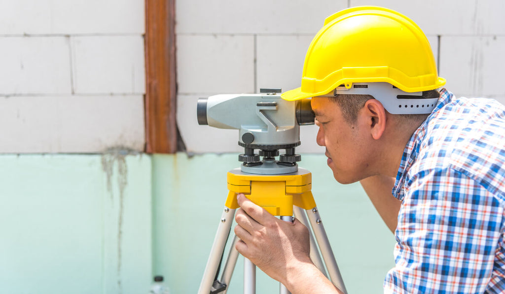
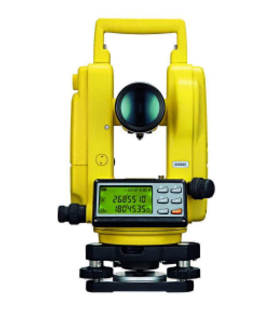
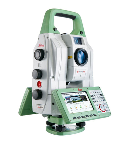
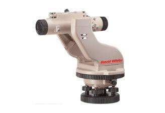
Land surveyors make use of sophisticated equipment, like theodolites, total stations, GNSS receivers, prisms or retroreflectors, clinometer, 3D terrestrial scanners, transit levels, underground locators, and drones. With these surveying instruments, they can make calculations, collect information, and take images of the area. Then, using surveying software programs, they draw up plans and draft map measurements.
Some land surveyors work for developers, and they help establish boundaries and subdivide properties. Virtually any location where people plan to reside must be surveyed to avoid trespassing. Aside from this, land surveyors can also work on infrastructure building, tunnel excavation, mining projects, and other construction projects. Since surveyors are the first to know about the area’s features, they serve as invaluable consultants for other professionals, like architects, engineers, and contractors. Land surveyors might also be tasked with projects that involve establishing property boundaries. Because of this, they must know about property law and keep up-to-date with any revisions to this law.
Skills and Core Responsibilities
With the number of tasks that land surveyors take on, it isn’t at all surprising that these professionals usually possess a broad range of expertise. Let’s take a look at what land surveyors do exactly and the general skills they need to have to get the job done.
1. Mathematical Know-How
While knowing a little bit of science and programming can go a long way in surveying, the principal role of land surveyors involves math. They measure distances and angles, determine slopes, find the differences in elevations, and perform various geometric and other mathematical calculations. Naturally, the results that land surveyors submit to their clients should be free of errors.
Land surveyors are typically equipped with specialized tools, such as measuring wheels and global positioning satellite devices, to collect data accurately. At the same time, they need to be equipped with the right mathematical skills to get accurate results. The calculations that land surveyors make are critical for legal property boundaries, easements, major construction projects, and many others. That’s why accuracy in surveying results means effective planning and preventing rework.
2. Attention to Detail
Since accuracy is a sought-after factor in surveying, land surveyors should be detail-oriented. The documents that surveyors produce are regarded as legal documents. That’s why every information that surveyors collect and present should be true and precise. This entails correcting errors in even the most minute details and making exact measurements within a margin of error.
Attention to detail comes in handy when surveyors delineate boundaries and establish reference points. The data collected from these tasks will help surveyors calculate their results. This means that from the very start up until the end of the job, attention to detail is a must for getting accurate results.
3. Research and Problem-Solving
Surveying requires collecting information about the area. Apart from measuring, another task that land surveyors need to do is researching. This task involves procuring legal documents about the land, looking for information about past surveying activities, and researching land titles.
The data that land surveyors collect from their research will serve as an essential reference when they do their tasks. That said, problem-solving is also a required skill in surveying. This skill allows surveyors to settle any inconsistencies in documents. In addition to this, it helps surveyors provide immediate solutions to unforeseen problems, such as broken devices and complicated equipment.
4. Communication Skills and Report Writing
After collecting information and calculating measurements, it’s time for surveyors to present the final results to other people. Knowing how to communicate clearly might not seem like a skill that surveyors should have, but in reality, it is an indispensable skill in a surveying career. The results that land surveyors present should be clear and detailed to prevent any misunderstandings. Moreover, land surveyors often have to relay instructions to clients, colleagues, and even government officials, so clear communication is a must. They also have to communicate with developers, lawyers, and construction professionals to report any changes and updates.
The communication skills of land surveyors should also be present in their reports. These professionals need to make detailed reports that will serve as references for legal boundaries, development activities, and future surveys and projects. Because of this, the information presented in survey reports should be complete, comprehensive, and free of errors.

5. Efficiency
Managing time and making the most out of limited time are two things that land surveyors should be capable of doing. Time is of the essence in surveying and construction projects. The longer the project takes, the more money is being spent. Land surveyors should be able to work within tight deadlines and be efficient when it comes to completing tasks.
6. Stamina
While surveyors generally need a number of soft and hard skills, they should also possess physical skills, particularly stamina. Surveying often takes place outdoors. That’s why land surveyors should have the endurance to walk long distances, work in various terrains, and stand for long periods.
Becoming a Successful Land Surveyor
Getting into a career in surveying might seem intimidating, what with all the technical skills that surveyors should have. However, being a land surveyor can be a fulfilling, exciting, and rewarding profession for other people. Moreover, the demand for land surveyors is expected to increase by 6% from 2018 to 2028, so there are certainly job opportunities in the industry. Land surveyors also earn a median salary of around $60,000 when working in construction firms and $70,000 when working for government contractors. If a career in surveying sounds appealing to you, it’s best to prepare the way toward becoming a successful land surveyor as early as possible.
1. Get the Right Degree
Like most careers nowadays, earning a college degree is a must to land a job as a surveyor. Some states might require you to get a degree from a school certified by the Accreditation Board for Engineering and Technology (ABET). Before getting started on your path to becoming a successful surveyor, you should consider doing your research and ask your state’s licensing board about their requirements.
To become a professional land surveyor, you can earn either an associate degree or a bachelor’s degree. Associate degrees for land surveyors are widely available, and they can prepare you for entry-level positions. These two-year programs include Associate of Applied Science Degree in Mapping Sciences, Associate of Applied Science Degree in Land Surveying, and many more. Most of these programs include courses like surveying concepts, surveying principles, technical drawing, physics, and mathematics.
A bachelor’s degree, on the other hand, is preferred by most employers today. This degree can be in surveying, geomatics, or mapping. Surveying-related bachelor’s degrees might involve courses like geographic information systems (GIS), satellite imagery, photogrammetry, calculus, and cartography.

2. Pass the Licensure Examination
Most states require aspiring licensed surveyors to take the Fundamentals of Surveying (FS) exam, which is conducted by the National Council of Examiners for Engineering and Surveying (NCEES). This six-hour-long, 110-question test is the first step to become a professional licensed surveyor. You can take the FS exam right after completing your undergraduate degree.
While most programs offer courses that will prepare you for the FS exam, it’s always best to take the extra mile. A quick online search will instantly provide you with numerous reference materials for taking the FS exam. The NCEES also posts the FS Reference Handbook on its website. This handbook is a great source for examinees as it contains useful information about the FS Exam and the process of taking it. Another thing that you must do on the NCEES website is to register for the exam. It requires you to pay over a $200 exam fee. Additionally, some licensing boards might need you to pay extra application fees.
Once you pass the FS exam, you can get your preliminary or temporary license from your state’s licensing board. However, some states require individuals to take state-based exams in addition to or in lieu of the FS exam. Other licensing boards also require additional materials before you can get your license. That’s why it’s best to visit the NCEES website and look for the link to the website of your state’s licensing board. This way, you can prepare for everything that is required so that you can get your surveyor’s license.
3. Seek a Surveyor Position
Passing the licensure exam will allow you to work as a surveying intern. Doing an internship can give you firsthand knowledge of what you’ll be doing as a surveyor, and it can also help you build connections in the industry. While receiving a quality education can come in handy, experience is still the best teacher. Moreover, doing an internship can raise your chances of landing a job at a firm you prefer to work for.
After you gain the needed experience, you can find surveying jobs at architectural or engineering firms, government agencies, mining companies, and utility companies. You can also join a surveyor association to expand your network of clients and potential partners. Surveyor associations can help you build your career, teach you new survey techniques, and provide you with endless networking opportunities.4. Develop Your Career
After a minimum of four years of experience as a surveyor, you can take another exam offered by the NCEES, which is the Principles and Practices of Surveying (PS) exam. The PS exam will test your ability to practice surveying competently. While passing the FS exam allows you to get a temporary license, passing the PS exam makes you eligible for a professional license.
If you think of going up the career ladder, you might want to consider applying for the Certified Survey Technician (CST) program. Conducted by the National Society of Professional Surveyors (NSPS), this certification program offers four stages. These stages include level 1 for entry-level positions, level 2 for those with at least 1 1/2 years of experience, level 3 for those with at least 3 1/2 years of experience, and level 4 for those with a level 3 certification and at least 5 1/2 years of experience.
What’s great about a career in surveying is that you can specialize in an area you prefer. There’s geodetic surveying, which makes use of high-quality imaging from aerial and satellite observations for geographical measurements. There’s also marine surveying, which involves identifying the topography and other features of the bodies of water. As you go along with your career, you’ll surely find an area of specialization that you’ll grow to like.

Choosing the Right Surveying Instruments
One cannot go into battle without the right weapon. Likewise, a surveyor cannot get the job done without the right tools. Surveying is a technique that involves a variety of methods, such as distance measurement, angle measurement, and leveling. Even in ancient Egypt, establishing boundaries, plumbing, and other surveying tasks call for simple surveying tools like rope stretchers and plumb bobs. As might be expected, surveying instruments have evolved over the centuries to accommodate new techniques and structures. For this reason, keeping up-to-date with the latest surveying technology can help you advance your career.
Land surveyors make use of a wide array of surveying instruments, which is why choosing the right instruments for the job can get pretty overwhelming. There’s also the factor of deciding which brand of surveying instruments to trust. Substandard surveying equipment made by lesser-known brands can easily break, and most surveying instruments nowadays don’t come cheap at all. Fortunately, Engineer Warehouse has carefully made a selection of the most commonly used surveying equipment made by well-established brands, such as Sokkia, Dutch Hill, Northwest Instrument, Nedo Surveying, and more. These manufacturers are well-reputed in the surveying and construction industries. That’s why you can definitely get the best bang for your buck with their products. You can rely on these top-quality surveying instruments for life and trust them to help you get the job done with the utmost accuracy and efficiency.


